Coastal Roadway Inundation Simulator (CRIS)
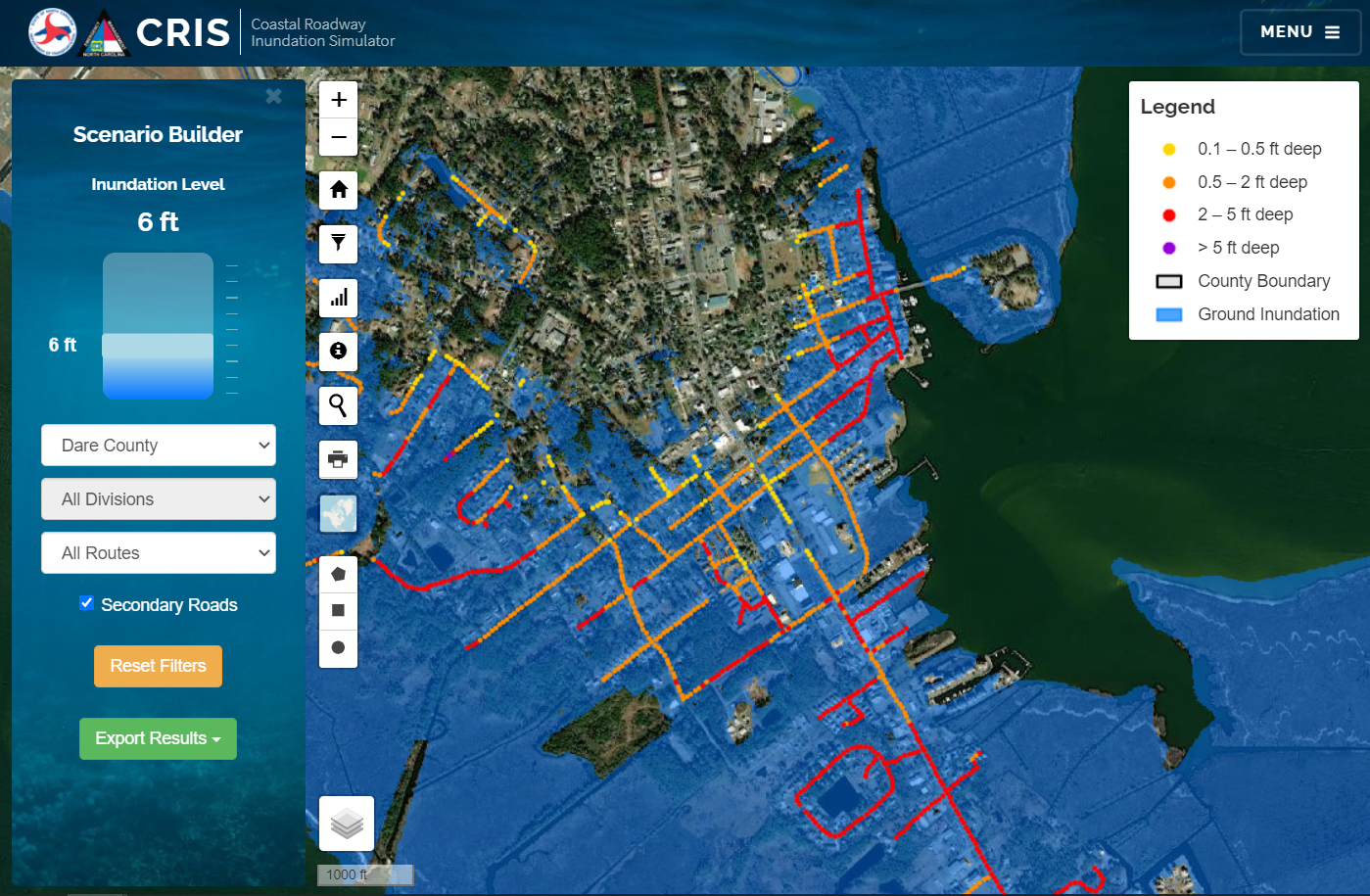
CRIS allows transportation planners and emergency managers to simulate predicted roadway inundation from coastal flooding and quantify potential effects of inundation. Inundation boundaries are derived from NC QL2 LiDAR data and are available up to 15ft (NAVD88). Users can simulate flooding on both primary and secondary roads and export results to a KML for further visualization. Simulations are limited to coastal counties only.
Open Application